Linking Lands Alliance – Science Mapping
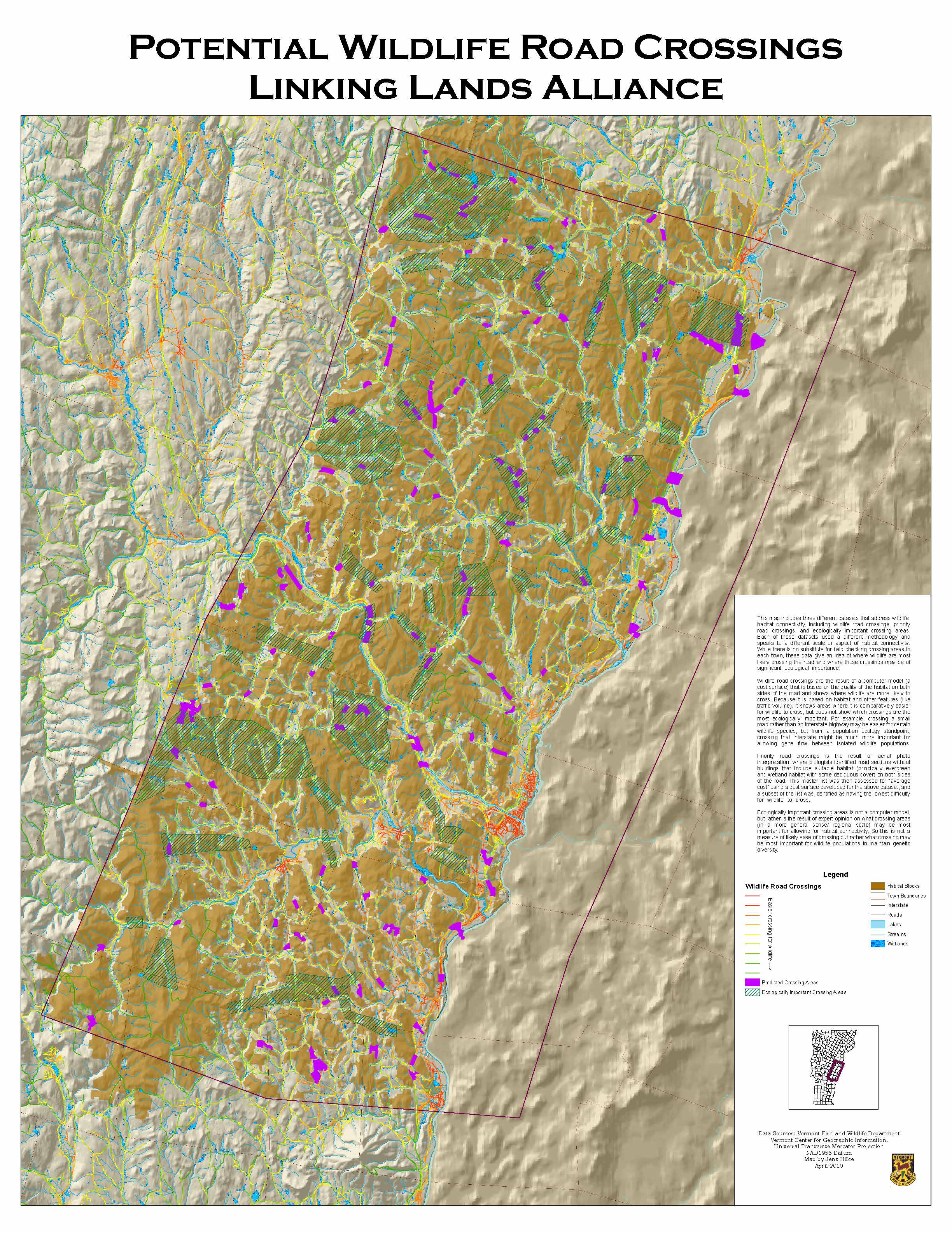
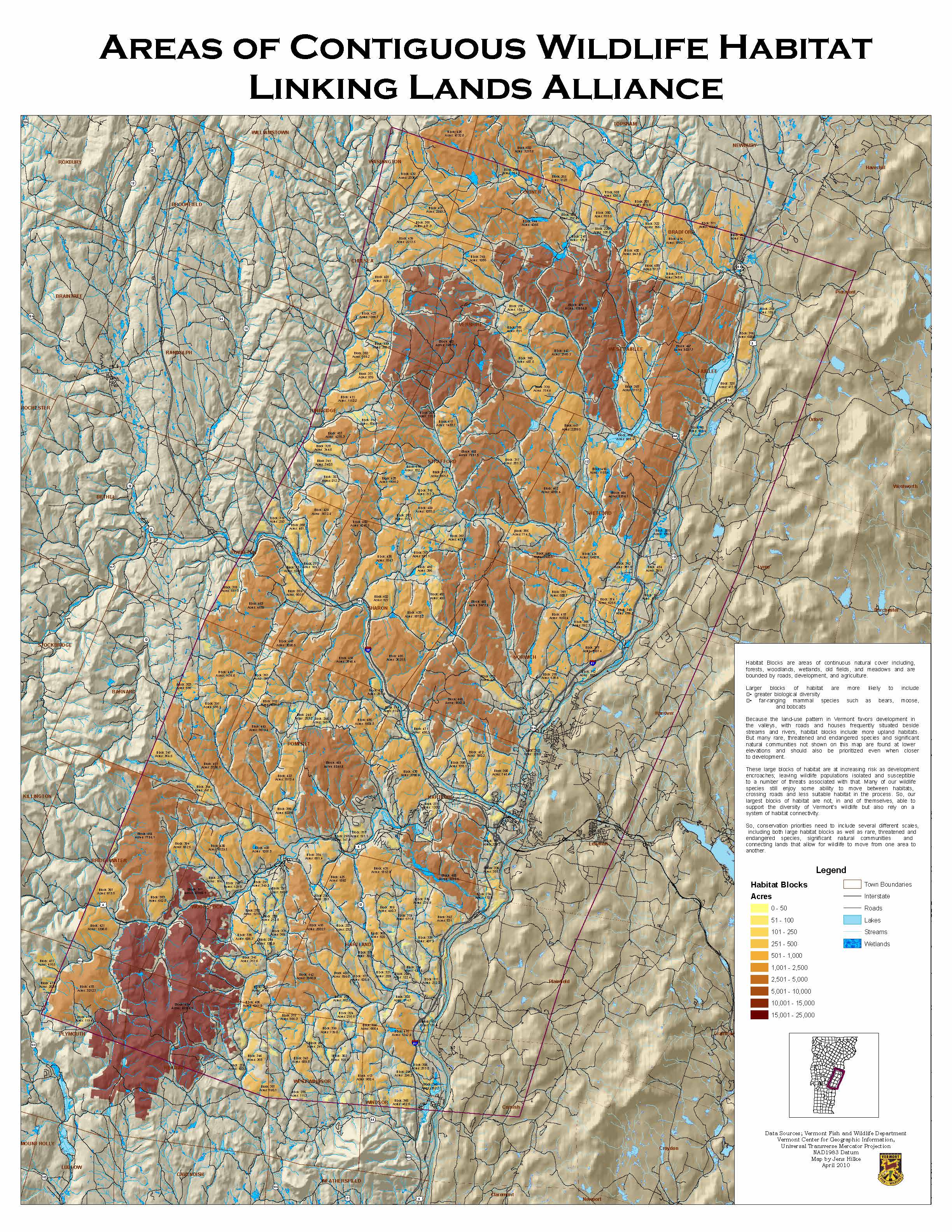
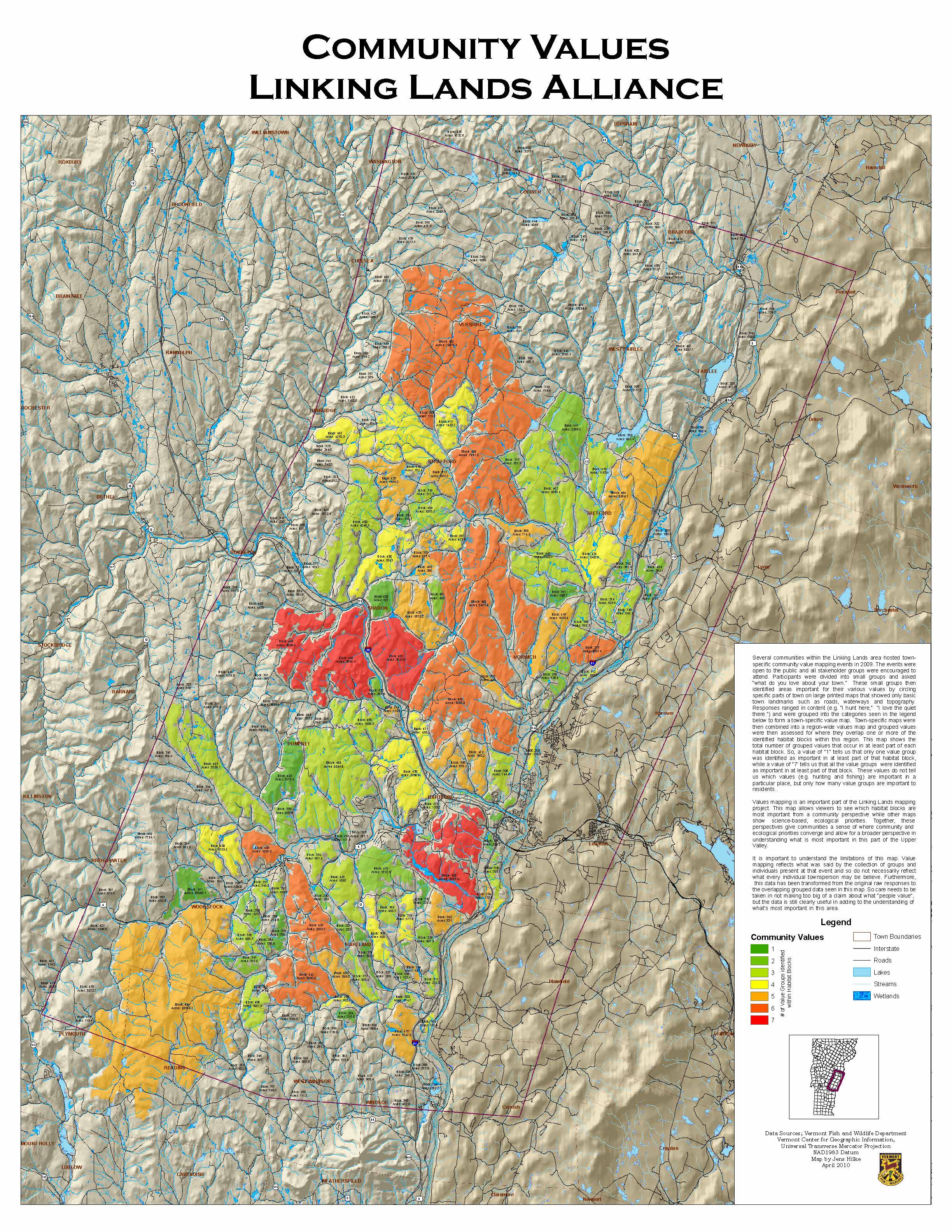
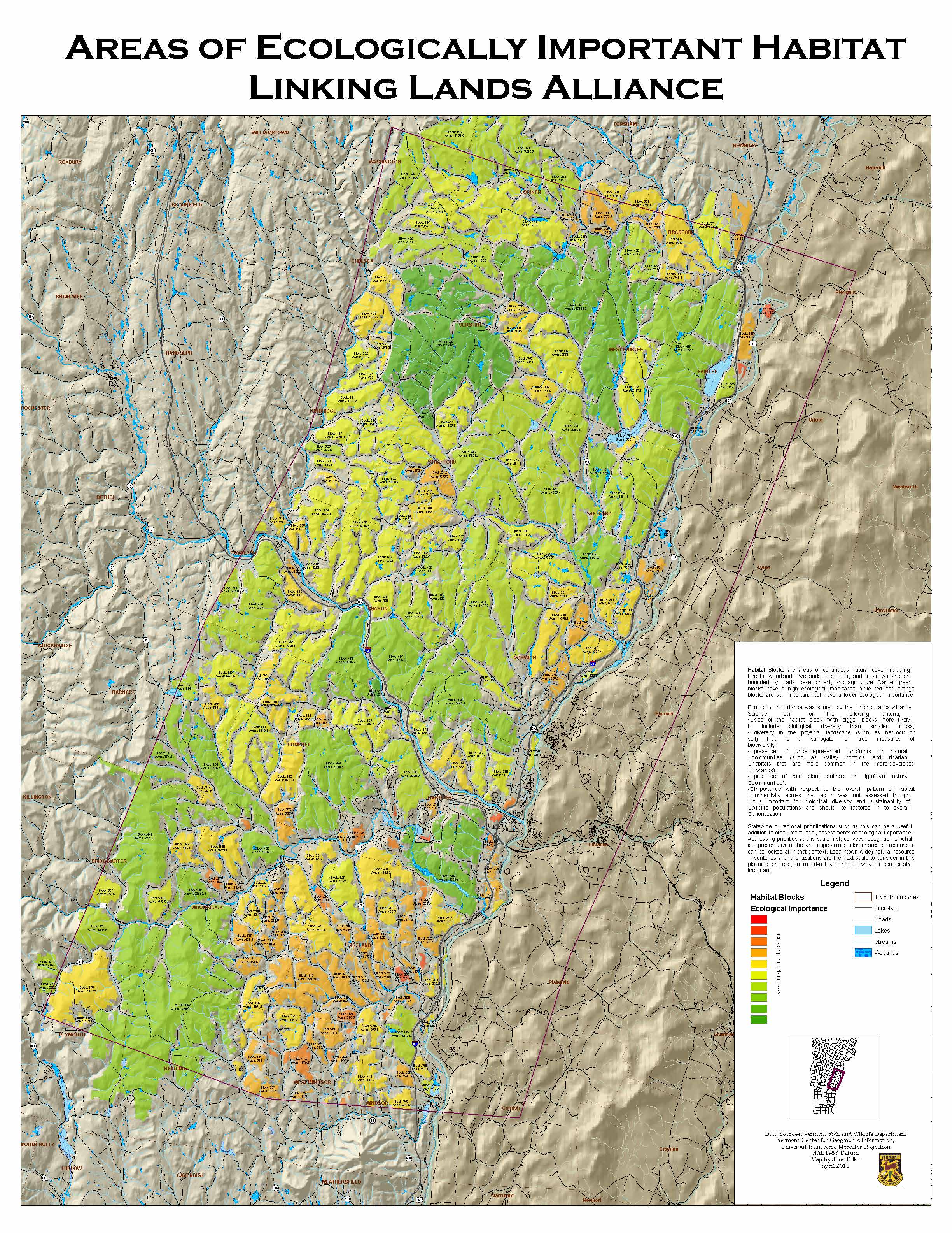
The Linking Lands Alliance (LLA) is a grassroots citizen group focused on conserving wildlife habitat and restoring forestland. The LLA is comprised of 10 towns located in the Upper Valley of Vermont (Hartland, Woodstock, Hartford, Vershire, Thetford, West Fairlee, Pomfret, Sharon, Strafford, and Norwich). In 2009, LLA contacted the Vermont Fish and Wildlife Department in hopes of creating a map of natural resources in their area. This resulted in a very collaborative effort between the members of LLA and Vermont Fish and Wildlife’s Department’s conservation planning biologist, Jens Hilke. The Vermont Fish and Wildlife Department provided much of their expertise, their dataset, and their general mapping protocol. This mapping project was unique in that it used community-based values (hunting, fishing, aesthetic values) collected from the residents to determine what type of land usage would be supported, and in what locations. The maps were created through aerial photo digitizing, where places colored red on the maps indicate the greatest concentration, or overlap, of community values. The resulting maps depict a landscape characterized by a pattern of larger and smaller blocks of forest cover. Places where forests blocks were close together and where there was little development were considered to be potentially important wildlife road crossing areas. Additionally, land was ranked by ecological importance, valuing places with rare plant species and rare habitats.
Hartford, Hartland, Norwich, Pomfret, Sharon, Strafford, Thetford, Vershire, West Fairlee, Westford
forest_land, inventory, land_management, land_protection, outreach, partnerships, water, wetland, wildlife
These maps have been used during presentations for conservation commissions, school children, and school field trips. Since the creation of these maps, individuals and communities in the Upper Valley have become more aware of important habitat blocks in their region and of the benefits of habitat connectivity. In raising public awareness, it is optimistic that this resource will be used to conserve significant wildlife habitat and potential corridors from being developed in the future.
Two Rivers - Ottauquechee Regional Commission
Vermont Fish and Wildlife Department
Hartland Conservation Commission
Woodstock Conservation Commission
Hartford Conservation Commission
Vershire Conservation Commission
Thetford Conservation Commission
West Fairlee Conservation Commission
Pomfret Conservation Commission
Sharon Conservation Commission
Strafford Conservation Commission
Norwich Conservation Commission
The assistance and expertise provided by the Vermont Fish and Wildlife Department was essential to creating the maps. Linking Lands Alliance is a voluntary group, so having a resource to do the work for them was critical. The many engaged volunteers and the commitment of these individuals throughout the years was crucial. The Two Rivers - Ottauquechee Regional Commission also provided technical assistance and still manages the data today.
In community-based value mapping, obtaining a true cross-section of the town as a collective is difficult because it is often the same individuals who are engaged in the town government, so you may be missing out on different beliefs of those individuals harder to reach. In order to alleviate this situation, towns communicated with their community members at the town dump where most residents were destined to frequent. Other towns held numerous meetings and tried especially hard to get the word out about the mapping project. Lastly, the beginnings of the mapping process were challenging, as there was minimal data in existence on the regional location of natural resources.